active
Field Atlas — 3D Interactive Travel Globe
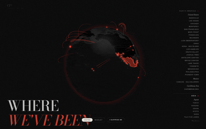
A 3D globe pinned with every place Carl & Rachel have actually been, each pin drawn straight from the photo archive. Spin it, click a city, and dive into the shots. Built with globe.gl + GSAP.
3dwebglthreejsgsaptravelcreative
Field Atlas — 3D Interactive Travel Globe
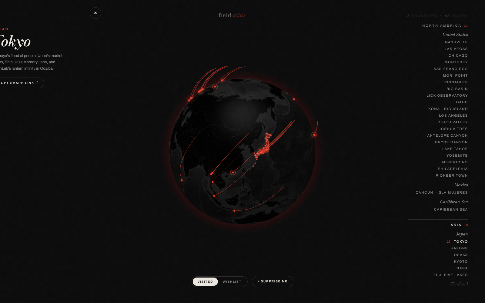
A 3D globe pinned with every place Carl & Rachel have actually been — each pin drawn straight from the photo archive. Spin it, drag to explore, click a city, and dive into the shots from that trip.
What it does
- Real coordinates, real photos — every destination is geolocated and backed by images pulled from the travel archive.
- Interactive globe — built on globe.gl (Three.js under the hood) with smooth GSAP camera moves between regions.
- Region index — a live list of every country and city visited, grouped by continent, that flies the camera to a location on click.
Tech stack
| Layer | Tech |
|---|---|
| 3D globe | globe.gl + Three.js |
| Animation | GSAP |
| Hosting | Static site on Vercel |
Live at map.carlfung.dev.
Surprise Me